Ettina Bhuja….a hidden gem of a trail in southern Karnataka. The trek to Ettina Bhuja is short and relatively easy. It is ideal for trekking enthusiasts, especially those with limited experience. Ettina Bhuja, about 1300 msl, is one of the numerous peaks in the Charmadi Ghats region of Karnataka. The name Ettina Bhuja is derived from classical Kannada meaning ‘ox’s shoulder’. The peak resembles the hump on an ox’s back. The trekking trail to Ettina Bhuja begins at Shishila, 15 kms from Dharmasthala. Usually, trekkers hire a jeep from Shishila to Holegundi where the actual trail begins. The peak lies 8 kms from Holegundi. A trek guide is necessary because this is a less-frequented trail and vegetation quickly covers the tracks, so chances of getting lost are high. Ettina Bhuja is visible through the trees at the beginning of the trail. The initial part of the trail takes one to the Kapila river crossing, a kilometer from Holegandi. Though the water level is not high, the current is quite strong and the rocks are slippery. A few minutes later, another stream flowing in the opposite direction, is encountered. This is a tributary of the Kapila river. The cool waters of this gentle stream offer respite and is an ideal location for a break. The trail lies alongside the stream, whose gurgling sounds accompany trekkers. For over an hour, one treks alongside the stream through patches of leech land. A mini waterfall, gurgling sounds of the water, thick canopy of trees, gradual ascent and an undefined trail are the highlights of this stretch. The trail moves slowly away from the stream and the gradient increases. This stretch has a rich variety of mushrooms that make for great images. The forest cover gives way to grasslands and one gets another glimpse of Ettina Bhuja.
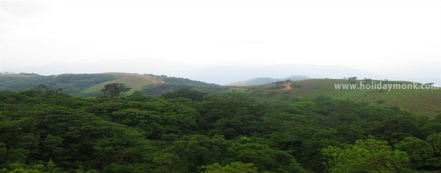
Rolling hills and green valleys stand between the trekkers and the peak. The path to the peak takes one through hills and valley and through shola forests and grasslands. This stretch, lasting over two hours, is very tiring. It is advisable to take breaks from the scorching sun by taking shelter under tree cover during the crossovers. The ascent is steep and is a true test of nerves. At a the base of the imposing peak, lies a beautiful grassland. The final ascent to Ettina Bhuja is from behind the peak. Trekkers planning to camp near the peak set up camps and ascend the peak when the sun begins to set. The scorching heat can sap one’s energy easily. Seasoned trekkers take a small break and proceed to conquer the peak. The meadow is deceptively close to the peak. The final climb takes about 30 minutes and is completely exhilarating. The adventurous attempt a 70-degree incline and climb on fours in some stretches to reach Ettina Bhuja. The less strenuous route circles the peak and takes one along rocky ridges. The views from the ridges are mindblowing. There are deep gorges on one side and rocky patches on the other. With hearts in their mouths, trekkers reach Ettina Bhuja.
Ettina Bhuja offers breathtaking views of the peaks of the Charmadi Ghats including the Ombattu Gudda and Amedikallu. The peak offers beautiful sunset views. The Bhairaveshwara temple in the plains is clearly visible. The rocky peak is windy and there is no tree cover to offer respite. Trekkers camp in the base below the peak amidst the chilly winds, starry skies and cold weather. Ettina Bhuja is not the tallest peak in Charmadi Ghats and hence sunrise arrives late. The sun lights up the peak in its golden glow – a sight that will remain etched in your memory. Trekking to Ettina Bhuja amidst the tall elephant grass, damp forests, wide variety of mushrooms, harsh sun, slippery rocks, tricky trails, and open skies is popular among the trekking community in South India. The peak looks imposing from all directions and hence the final challenging ascent leaves one with a tremendous sense of achievement.
MORE


